
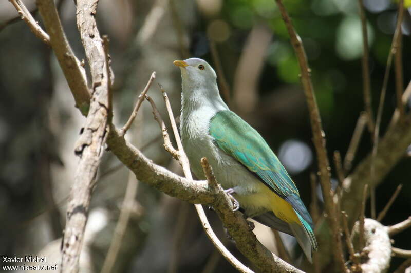
Grey-green Fruit Dove - Ptilinopus purpuratus
Ptilope de la Société
The species
Classification
Order : Columbiformes
Family : Columbidae
Species : Grey-green Fruit Dove
Geographic range by countries
specie's pictures
The picture
O.Net ref. : xami112746
Author :
X. Michel
Plumage : adult
Shooting
date : 2011 Dec
Country :
French Polynesia (fp)
Place : Mont Tamarutofa
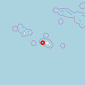
Lat. : 17° 31' 18'' South
Lng. : 149° 49' 17'' West
Exif Data [+] [-]
Model : Canon EOS 7D
Exposure : 1/1000 s
aperture : 5.6
Focal length : 400 mm
Iso : 320
Flash : no